Mapping a Blueprint to Save Critical Ecosystems

One Earth / 2020 / Environment & Climate Change

Mapping Application built in Google Earth Engine for One Earth, showing the Global Safety Net data layer

Overview

Graphicacy designed and engineered the Global Safety Net (GSN) Data Viewer application for One Earth, in partnership with Google Earth Engine.

Background and Challenge

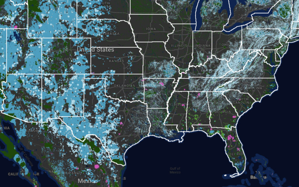
One Earth came to Graphicacy for help bringing the Global Safety Net report to life in a visual way. This research effort builds upon an array of global-scale data sets to identify areas that require conservation beyond the 15.1% of the land area currently being protected.

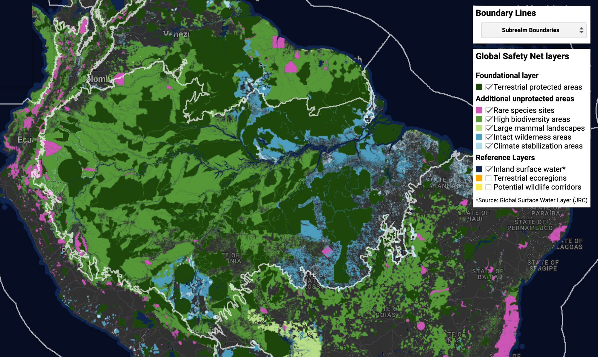
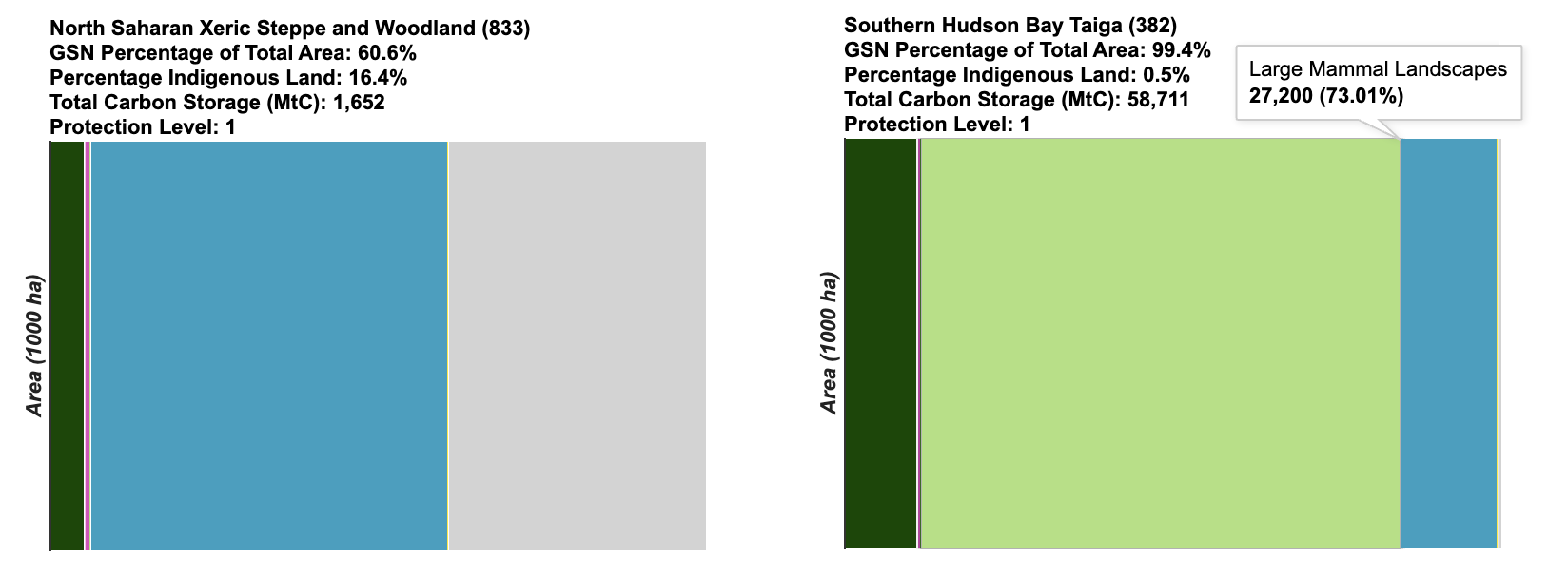
The Global Safety Net application brings together the World Database on Protected Areas (WDPA) with 11 leading conservation priority frameworks, additively compiled into five main geospatial layers—species rarity sites, high biodiversity areas, large mammal landscapes, intact wilderness, and additional climate stabilization areas — that total 50.4% of Earth’s terrestrial surface.

While the important research of the Global Safety Net report is an important advance in the released static report, Graphicay’s challenge was in making the complex data and research more accessible to researchers and climate activists.

Mapping Application built in Google Earth Engine for One Earth, showing the Global Safety Net data layer

Opportunity and Solution

This particular project allowed our team to design and engineer an interactive visualization that highlights one of the most pressing issues facing the world today: climate change. The report was published in Science Advances and highlights the importance of protecting and restoring the natural world to address three converging crises: climate change, the loss of biodiversity, and the emergence of novel viruses such as COVID-19.

Our team focused on making it an engaging, intuitive and innovative platform for users to explore the Global Safety Net findings by ecoregion, country, and the 50 United States through the integration of Google Earth Engine and front-end JavaScript frameworks.

“Graphicacy’s skilled data visualization work allows users to explore the underlying data of the Global Safety Net report, bringing the report’s data to life and making it much more accessible for scientists, practitioners and policymakers who are serious about combating climate change.”


Karl Burkart, Managing Director, One Earth.

Interested in working on a project like this?